

First of all, that the mobile can become a very useful tool for excursions, but that is not why we must stop paying attention to the most basic elements. Caps, backpacks, sunglasses … and a lot of other things are essential in case of a complicated situation, something that our phone is not going to solve.
We can find really interesting itineraries that, in addition to allowing us to do sports and relax, will leave us with our mouths open for its amazing landscapes. Some of them are the route of the Arribes Del Rio Duero, the Irate forest and Foz de Lumbier, the Jerte Valley and the Sierra de Guadarrama.
Maps, compass, altimeter, what should a hiking app bring?
In the first place, it is essential that these applications have a good system of Location to know our position at all times and share it with our loved ones. Also, if they have maps It will also be of great help to us in any situation. In case you did not know, on many occasions we are going to find ourselves without coverage on our phone, so we must always have these items at hand if we do not want to get lost or be cut off. Another important aspect is that they can connect to Smart Watches, which use less battery and thus we will save having to take the mobile out of the pocket all the time.
Use your mobile to do routes and excursions
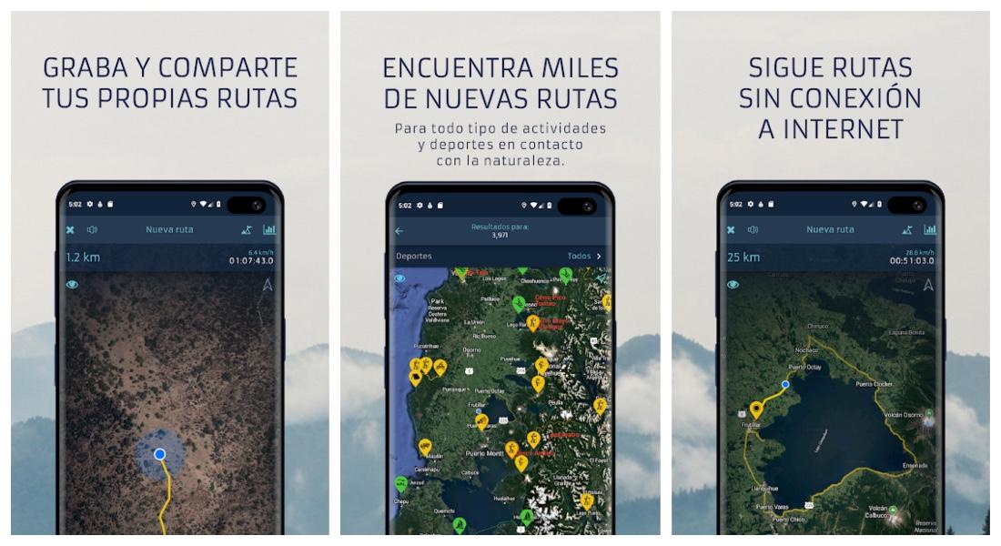
Wikiloc
 In this application you can choose between more than 75 different types of activities, such as kayaking, cycling routes or running. You can easily plan routes thanks to its multiple offline maps from all over the world and take photos to share with your friends and family. The waypoints will allow you not to get lost at any time during the excursion, and you can upload them to the app itself so that other users can take advantage of it. It also has a weather forecast and search by area of passage, where we can check other routes near your position. If you get its premium version, you will help the development of the application and contribute to non-profit organizations to improve the planet.


Komoot
An app destined to have adventures that you will never forget. Dispose of voice navigation so as not to get lost, and it works in the most remote places, being able to do it even without an Internet connection. You can plan the route to the maximum and know all the details of the path such as the type of road, the distance or the difficulty. Thanks to its offline maps you will be able to consult its high resolution maps easily and quickly. On the other hand, you can consult the favorite places of other users in its large community, as well as share your experience by recording the itineraries. Lastly, you can sync your favorite routes across all your devices.


ViewRanger
This application is fully compatible with devices OS WEAR by Google. These smart watches will show us the best hiking trails in detail. You can check the trails and their characteristics and shortcuts on your wrist to know the itineraries in advance. It displays heading data such as bearing, longitude and altitude, and is also optimized for other smartwatches, such as the Casio PRO TREK. It is compatible with Android Wear, its own navigation system. Of course, we must be connected to the Internet to have access to all the functions.

Outdooractive
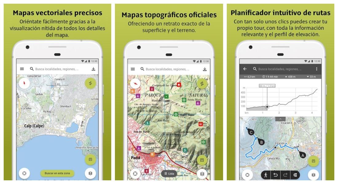
This app is one of the best tools for hiking and other outdoor activities. It has routes from countries around the world and you can easily plan them. Their vector maps They show detailed information of all kinds of roads so that you know everything about them in advance. In their suggestions you can find a lot of trails with all the characteristics and the steps to follow in each one. In addition also add text and photos and post them in your large community, or share them with your friends. And there is more, since you can import files with extension GPX. If you have a WEAR OS, you can have all the information on your watch and save battery on your mobile, even without Internet.


SUDA Outdoors
An application that in addition to letting us plan routes, shows us general information to perform any of the 50 sports it offers. With whom we can go hiking, where and what equipment we need before diving into the adventure, as well as the places to buy it. It also offers you recommendations from its users so that you have more information and details of each itinerary. Includes offline maps to download and check positions and images so you don’t get lost at any time. To do the live monitoring we must be connected to the Internet, although if we lose the connection it will recover the signal and the data quickly.


Bergfex
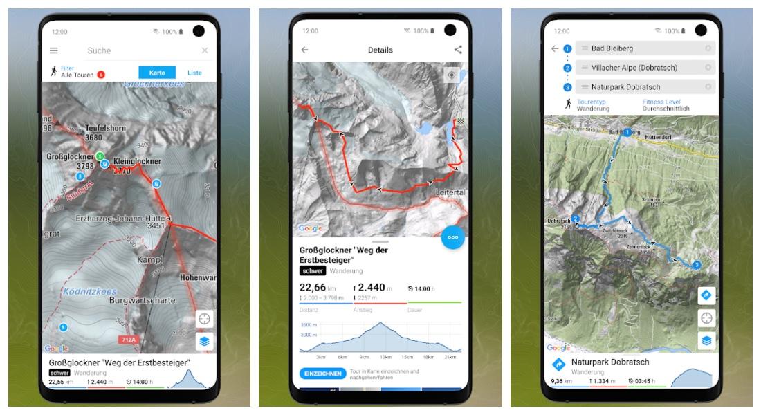
Bergfex classifies its more than 70,000 routes across Europe in a very comfortable way thanks to its different categories. The information of the itineraries is certified by operators or industries prestigious tourist attractions, so you will have the best data. Also, they are updated frequently. Each route includes very useful tips such as places to park vehicles or the necessary equipment for the excursion. In addition, if we get lost or deviate, it will begin to issue alerts for you to get back on the road. Finally, it offers a very comfortable and easy-to-use interface, and can be docked for use with a pulsometer, both chest and bracelet.


AllTraills
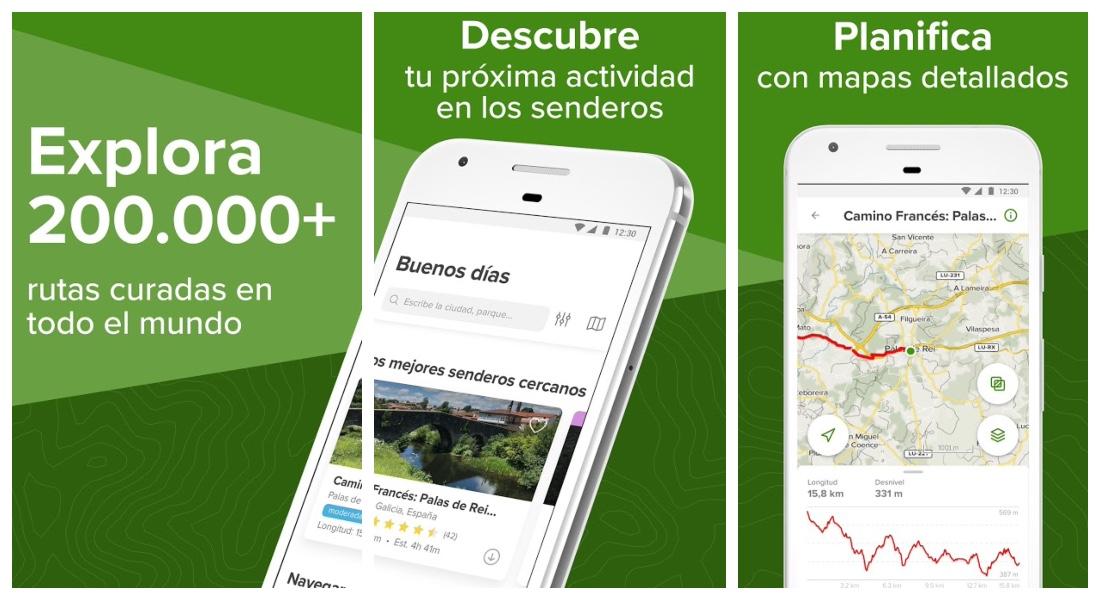
More than 10 million of downloads on Google Play, this app offers us more than 200,000 routes around the world to do all kinds of activities. It includes very well detailed hiking maps, and while you walk it shows you real-time information about the itinerary, in addition to tracking by GPS. One of its most outstanding features is that you can activate airplane mode on your phone and still continue to record your progress. Like the previous ones, you can create your own routes, add photos and text and save or share them with your large community. If you bet on its premium version, you can save your routes offline and access information such as the air quality or the pollen in the environment.

Gaia GPS
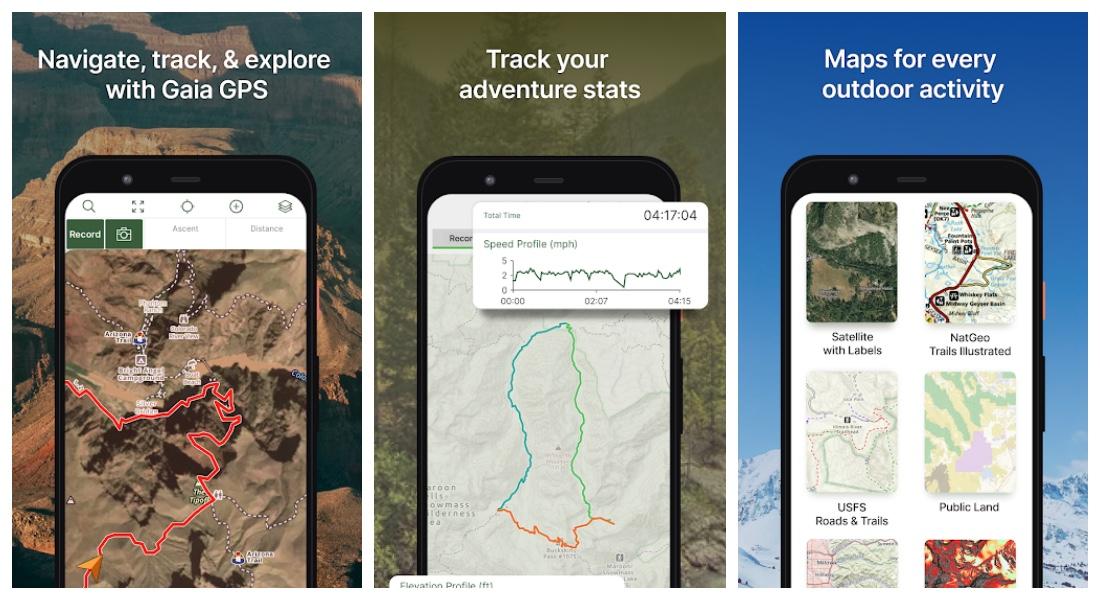 Gaia the Greek world is the goddess of the earth and nature. This app is considered as one of the best outdoor map apps. It includes the best routes and itineraries from around the world. You can easily download topographic maps, from roads Y aerial from around the world, all for free. You can synchronize all your routes on your devices, make backup copies and easily share them with your friends or users of this community. Through a simple and attractive interface, you can upload geotagged photos so as not to get lost at any time, as well as customize it to your liking.


E-walk
And we finish the list with E-walk, an app that allows us to download maps, plan routes and show our location offline. You must bear in mind that it is not available in Spanish, being able to establish it in English or French. If at any point during the excursion you get lost, it will take you to the starting point. In addition, it also offers places to camp and rest areas. Allows you to create files KML on the map with markers and information lines. Its interface allows you to store the trails in folders comfortably. Your version premium allows you to support the development of the app, have a scale on the map and eliminate annoying ads.


